
Monsoon!
An Arizona Summer Phenomenon
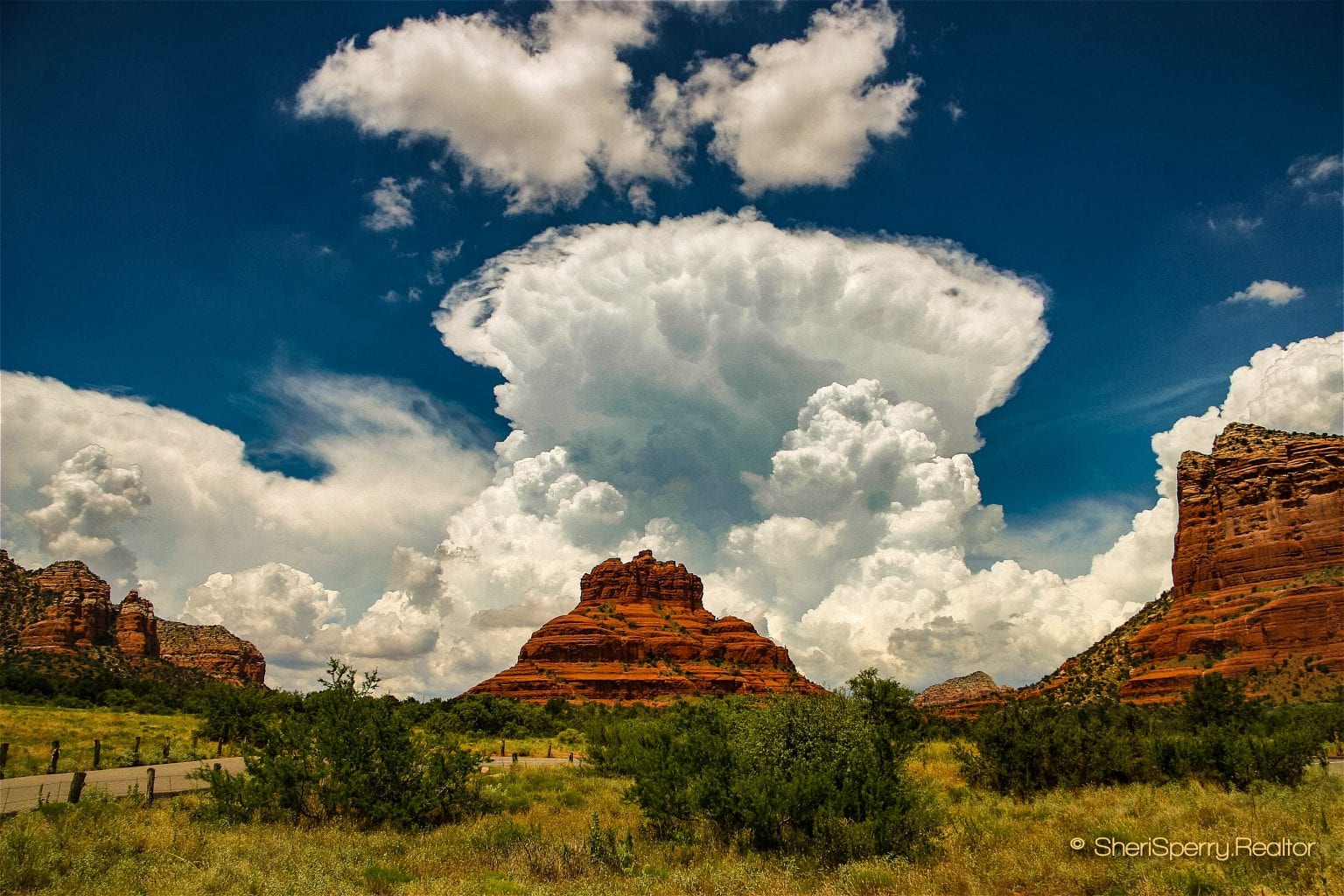 Bell Rock Sedona – Thunderhead Increasing

A similar article was featured on ActiveRain in 2019 – The largest and most active professional social network in the real estate industry…
Sedona Weather Update July 2023
As with most of the west and southwest, Sedona is experiencing some of the warmest weather we have ever experienced. A high-pressure area over the southwest has been stagnant for days. It is keeping the monsoon from developing over much of the state.
So far, we have had 23 days over 100º. We average around 26 days over 100º for the entire year. Sedona has experienced nine days over 105º and a total of 12 days in a row over 100º in June/July. This is highly unusual. Last year (2022), the warmest day of the year was July 20 at 106º. Today, it is already 109º!
Fortunately, our morning temperatures have averaged mid to high 60ºs. We can open the windows at night, even in these warm temps.
Humidity has averaged 27%, with lows during the warmer temps at 9% or less.
All stats are from weather station KAZSEDON183 located in the Cottages At Coffeepot in Soldiers Pass, West Sedona.
~ ~ ~
Information on Monsoon – Sedona, AZ – First of all, there is no need to add season at the end of Monsoon because Monsoon is a season. Monsoon affects the western and southwest states because the pattern of the weather changes, as noted below.
How Long Is The Monsoon In Arizona?
Monsoon officially starts on June 15th and ends on September 30th. However, most of the rain comes from the middle of July through the middle of August. This is one of the reasons Sedona’s temps are less harsh during July and August. The average rainfall in the state of Arizona is around 12.5 inches. The Sedona area gets more than the average rainfall. We have had as much as 26 inches (2016) and as low as 13.66 inches (2014). We had our lowest total of rain and snow in 2020, with only a trace of snow and 8.15 inches of rain. Sedona has shown improvement in drought conditions. In fact, the Coconino Forest has lifted a campfire ban because of all the rain we have received. See the actual precipitation chart on Sedona-Weather.com.
What Creates Monsoon Conditions?
Weather enthusiasts, forecasters, and wonks look to the dew point to tell if monsoon conditions exist. The dew point must be about 55º for thunderheads to start development. The dew point indicates how much moisture is in the air. At this point, the air cannot hold water in gas form, and the gas will turn to liquid form creating water droplets. The water droplets create fog or precipitation. Before officially declaring a calendar season for monsoon, the season would be declared when there were three days at a dew point of 55º.
Monsoon Has Yet To Develop in 2023…
Yesterday, a thunderclap jolted Rick and me out of our chairs. I don’t think I have ever heard thunder that loud. But, there was not one drop of rain!
Preparation For Monsoon
One quick note – Because it is our rainy season and the chance of lightning during a thunderstorm could knock out power, take some time to have things ready to go:
- Know where the flashlights and candles are for easy access.
- Keep your cell phone charged.
- Clean out gutters – drains – culverts – rain ditches, and any other natural path water may take during a sudden downpour.
- You should have sandbags prepared to divert rain that may cause flash floods.
- Thin trees close to your home. Many trees fall during high wind conditions.
What Is Monsoon?
It seems that Southern Arizona, the White Mountains, and the Phoenix metropolitan area known as “The Valley” get the brunt of the monsoon effects. It is amazing to see the haboob (desert wind storms)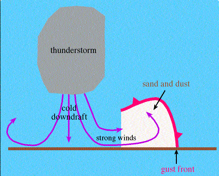 kick up and tower thousands of feet in the air, moving through the valley. Those storms are the precursor to the rain and massive storm cells that develop from the moisture in the warm air coming off the Gulf of Mexico. Generally, massive amounts of rainfall create downdrafts that push the air out from the storm’s center, producing a dry wind that kicks up the dust and dirt.
Seasonal Weather Patterns 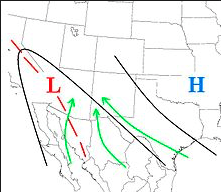
During summer, weather patterns change. Storms that travel from the Arctic (Alaska) down through Canada and the Lower 48 create our winter storm pattern.
In the summer, the pattern shifts to the south. Hurricanes, storms, and moisture travel northwest from the Gulf of Mexico through Mexico, Texas, New Mexico, and Arizona, moving all the way to California. We also get moisture coming from the Gulf of California, traveling directly north. Lots of moisture and an occasional hurricane come up from the coast of Baja, California, and push northeast into Arizona.
Northern Arizona
In Northern Arizona, we get a lot of cloud cover, and the storms move through but usually don’t drop a lot of rain here in Sedona. Though in Flagstaff, it is quite a different story! The area of Sedona seems to be protected. By that, I mean that most of the rain falls elsewhere before it gets to our little city. But when we do get rain and storm cells, it is a big deal around here.
In 2014, Sedona got 7.73 inches of rain from July through September. In 2013, there were 8.18 inches of rain in the same time frame. Flash flooding can happen because many of the streets are sloped, leading up to the red rocks. Much improvement has been made in our drainage system to handle the additional water flow, but during an intense storm, there is no place for the water to go, and mud and rocks can travel across roads to find the path of least resistance. Do not travel through a road where water is more than 2 inches deep. A car can be swept away quickly.
Southern & Central Arizona
In Southern and Central Arizona – 2014 will be remembered as the “Monsoon of the Century.” All future monsoon activity will be measured in terms of 2014. Three significant hurricanes affected the weather in the southern half of the state. This caused a deluge, and many towns and neighborhoods suffered tremendous flooding damage due to flash floods, hurricane wind, broken canals, and water that had nowhere to go. Many long-time residents had never seen a deluge like we had that year. Sky Harbor Airport had a record rainfall of 1.59 inches, exceeding the all-time record in 1903.
Discover more about Sedona Weather
What is El Niño and La Niña? How Does It Affect Our Weather?
Some of the most incredible pictures are taken during Monsoon.
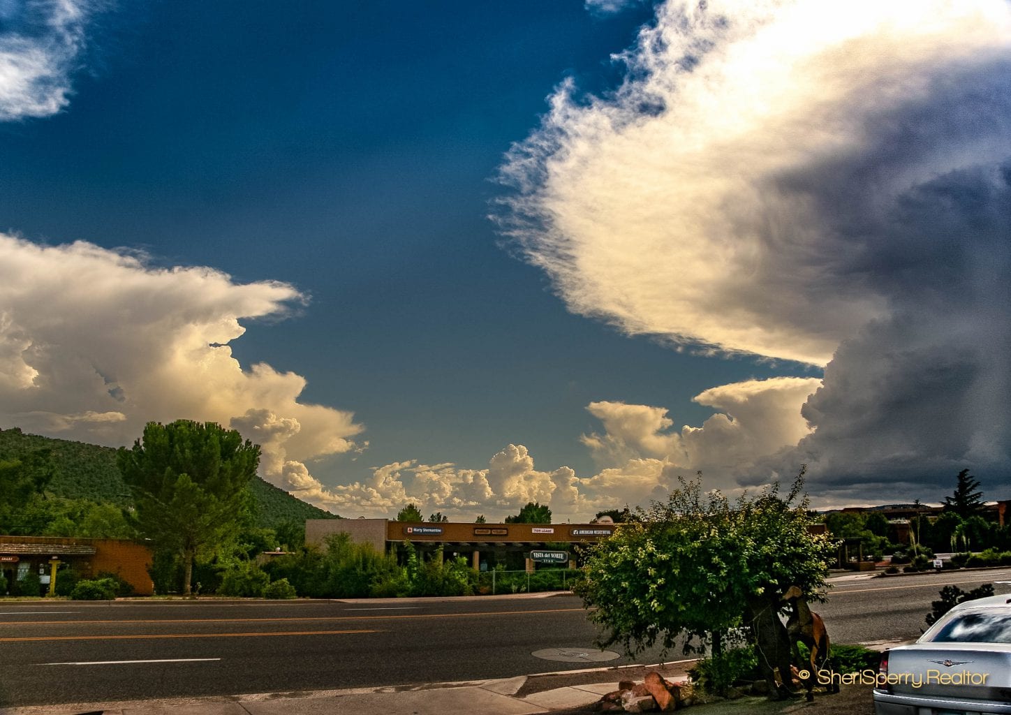
Thunderheads Surround Sedona
89A – West Sedona AZ – looking south

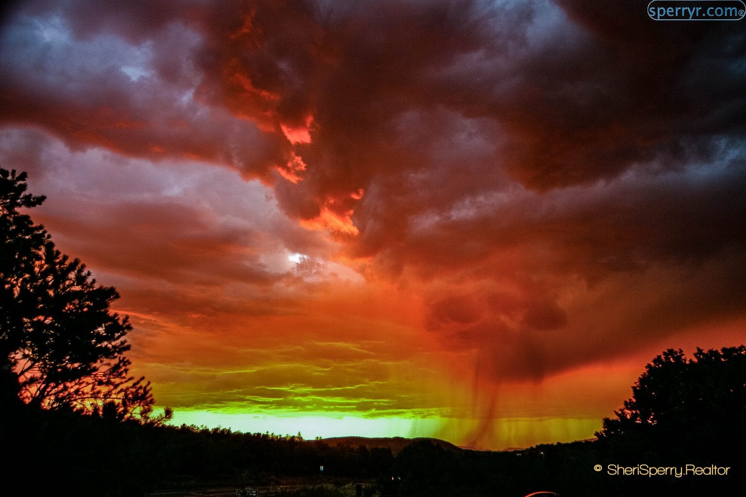
Massive Thunderstorm at Sunset creates Fire In the Sky.
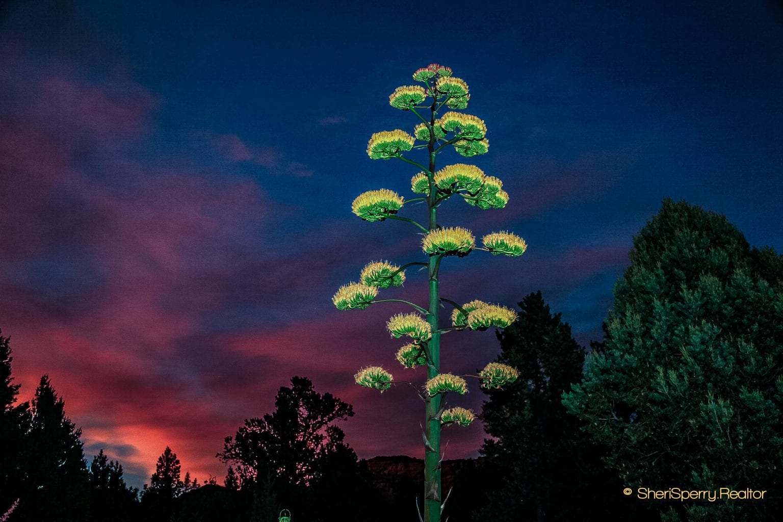
North View – Century Plant in Bloom
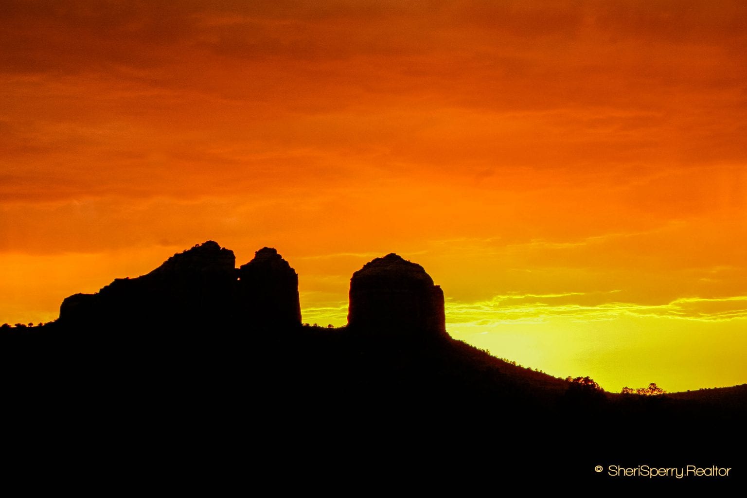
Cathedral Rock at Monsoon Sunset
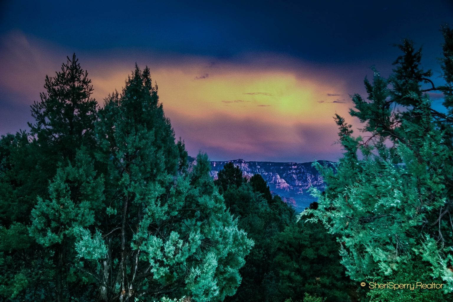
Looking Toward the Mogollon Rim
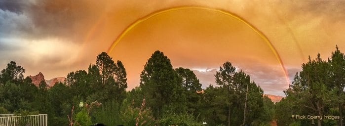
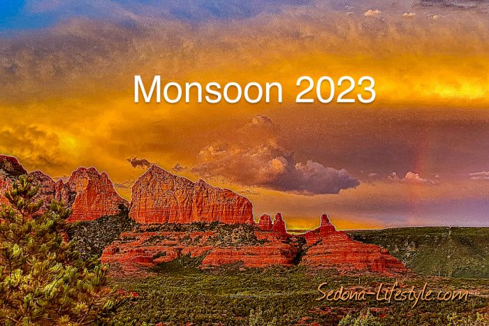
Rare Monsoon Sunset Rainbow
Click Here For A Video Of The Rainbow Above
It was taken just a couple of minutes before the sky went on fire!
;)